Marine Navigation 9.3.1
Paid Version
Publisher Description
MARINE NAVIGATION
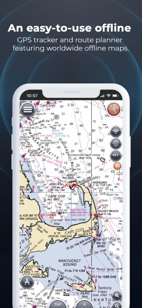
Find your way on the sea with ease! Our GPS chartplotter for boating is an easy-to-use offline GPS tracker and route planner featuring worldwide offline maps.
Whether you're a seasoned sailor, a fisherman, or just love water sports, this app is dedicated to the sea and the people who love it.
WHAT MAKES IT THE BEST GPS TRACKER AND NAVIGATOR:
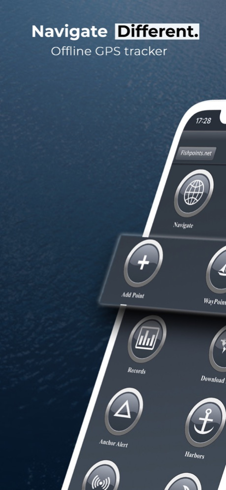
Offline GPS tracker for boat navigation. GPS chartplotter for sailing and boating.
Morse Code in case of danger, Anchor Alert to prevent the drift of the anchor, and Moon Phase to show the phases of the moon during the day.
Harbors feature to see the list of ports.
Sync Waypoints feature to be able to create backups and access them from different devices.
Download the maps and marine charts, so you won't need an active internet connection for navigation and route planning.
Create a profile to save waypoints and routes, and access them from different devices.
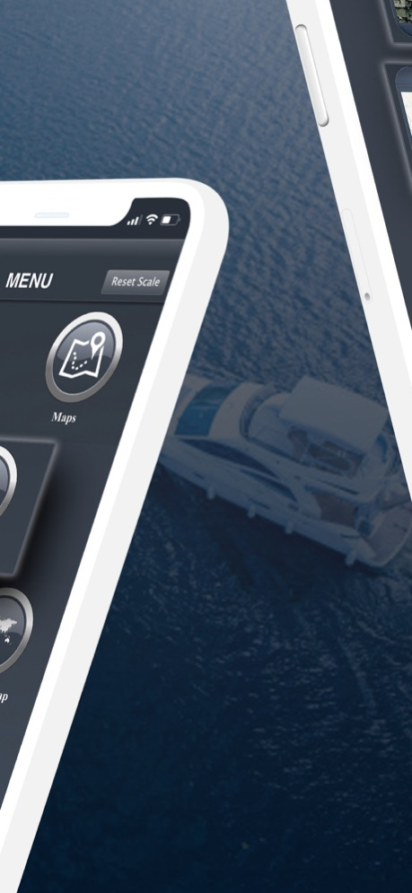
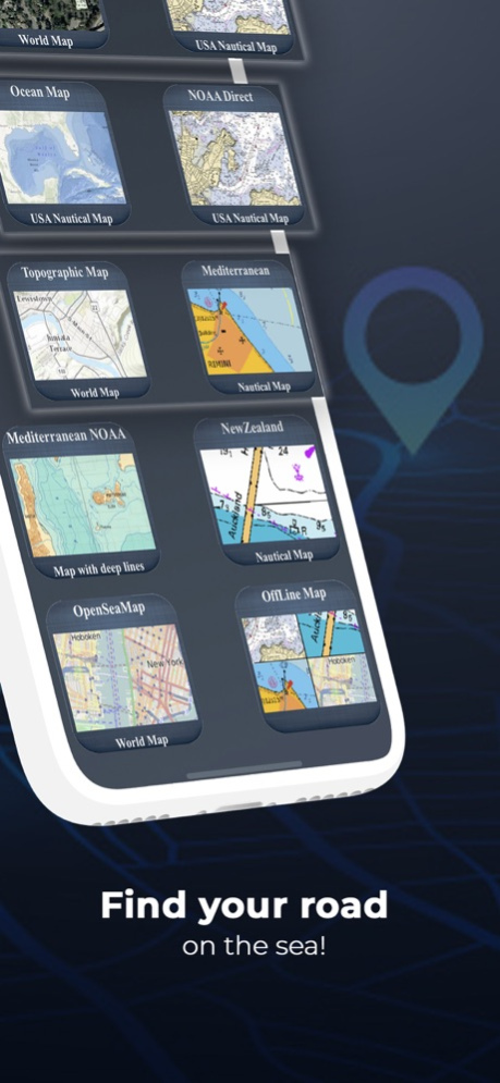
MAPS OFFLINE:
Download maps or marine charts to navigate on preloaded maps or charts without a connection.
MAPS AND MARINE CHARTS:
Nautical maps of the United States of America by NOAA.
Nautical maps of the Mediterranean by NOAA.
Mediterranean RNC.
Nautical maps of New Zealand by LINZ.
Maps of the world's oceans and coastal areas by ESRI.
World topographic map includes boundaries, cities, water features, ports, physiographic features by ESRI.
Satellite imagery for the world by ESRI.
Maps for the sea, with ports, sea lights, and more by Open Sea Map.
Beta Nautical maps by Fishpoints
MAIN FEATURES:
Super easy-to-use GPS tracker tool with a clean and neat design.
Weather feature.
GPX Import and Export.
Available in English, Italian, French, Spanish, Brazilian, Turkish, German, and Indonesian.
Download Maps to use in offline mode.
Accurate and detailed GPS Chartplotter, GPS plotter, and Marine charts.
Optimized for phones and tablets.
Receive information about speed, direction, and time to arrival.
Compass Magnetic or True.
Change Measurement Units: Km, Mi, or Nmi.
Record your route to analyze the data and renavigate your trace.
LOCATION PERMISSION
The app needs your location to trace the route on the map. Location information is processed locally on your device, ensuring your privacy.
TRY THE FREE VERSION
Get more details about the app by trying our Marine Navigation Lite version.
HELP US IMPROVE
Download Marine Navigation and let us know about any bugs, feature requests, or any other suggestions. Stay tuned for more features and options in this GPS tracker app for boating.
WARNING
Good seamanship requires the use of official charts. Marine Navigation is for use with other charts and cannot replace official charts. Use at your own risk.
LEARN MORE ABOUT FISHPOINTS
Visit our official website or join us on Facebook.
TERMS OF USE: http://www.fishpoints.net/eula/
PRIVACY POLICY: http://www.fishpoints.net/privacy-policy
Mar 18, 2024
Version 9.3.1
Update Esri Maps
About Marine Navigation
Marine Navigation is a paid app for iOS published in the Recreation list of apps, part of Home & Hobby.
The company that develops Marine Navigation is Marco Palaferri. The latest version released by its developer is 9.3.1. This app was rated by 1 users of our site and has an average rating of 1.5.
To install Marine Navigation on your iOS device, just click the green Continue To App button above to start the installation process. The app is listed on our website since 2024-03-18 and was downloaded 94 times. We have already checked if the download link is safe, however for your own protection we recommend that you scan the downloaded app with your antivirus. Your antivirus may detect the Marine Navigation as malware if the download link is broken.
How to install Marine Navigation on your iOS device:
- Click on the Continue To App button on our website. This will redirect you to the App Store.
- Once the Marine Navigation is shown in the iTunes listing of your iOS device, you can start its download and installation. Tap on the GET button to the right of the app to start downloading it.
- If you are not logged-in the iOS appstore app, you'll be prompted for your your Apple ID and/or password.
- After Marine Navigation is downloaded, you'll see an INSTALL button to the right. Tap on it to start the actual installation of the iOS app.
- Once installation is finished you can tap on the OPEN button to start it. Its icon will also be added to your device home screen.
